Explore cartography from different eras of Greene Street.
Click on each map to zoom, or view the original file.

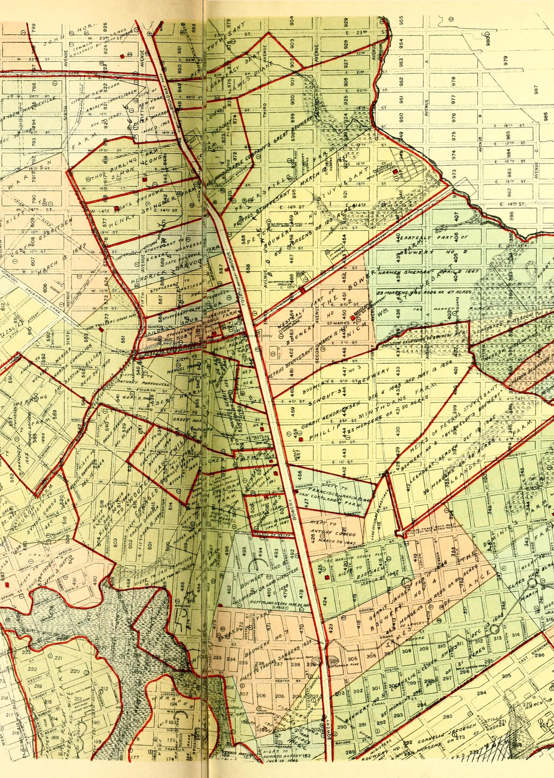
Map of Dutch land grants, from 2: Colonial
Source: I.N. Phelps Stokes, The iconography of Manhattan Island, 1498-1909: compiled from original sources and illustrated by photo-intaglio reproductions of important maps, plans, views, and documents in public and private collections, 1928.
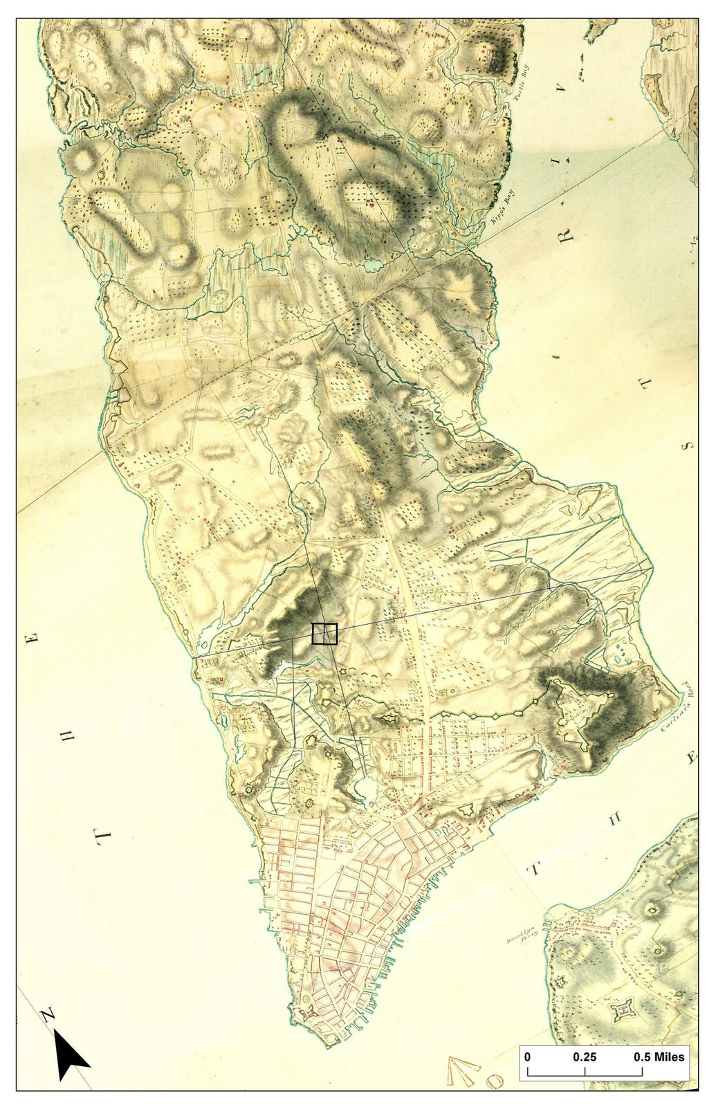
1782 British Headquarters Topography Map
Source: Welikia Project
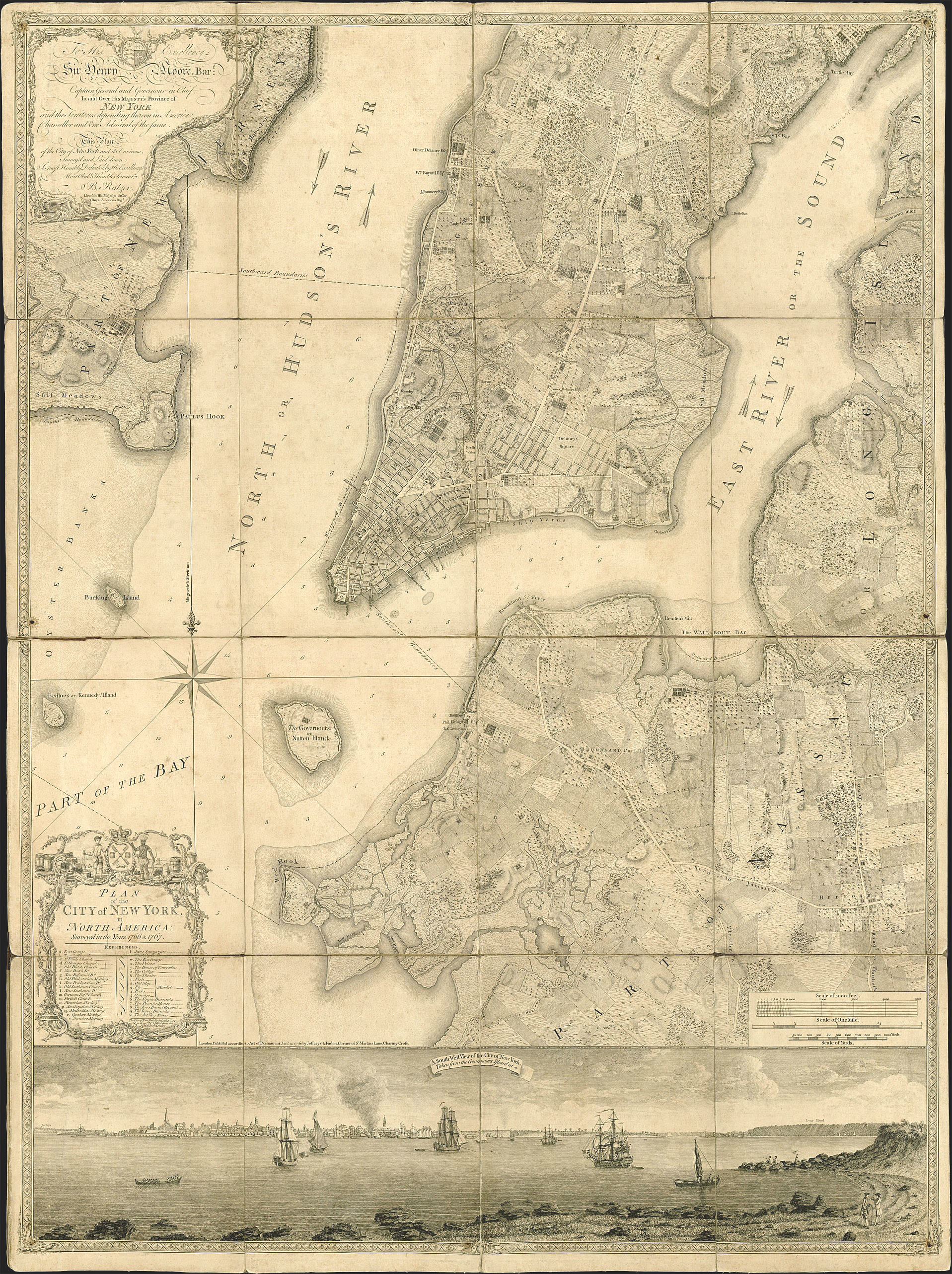
Plan of the City of New York in North America. Bernard Ratzer. ca 1770, from 2: Colonial
Source: Brooklyn Historical Society; image found at Museum of the City of New York

A Plan of the City of New York & Its Environs to Greenwich on the North or Hudson River,…survey’d in the winter, 1766. Montresor, from 2: Colonial
Source: Library of Congress
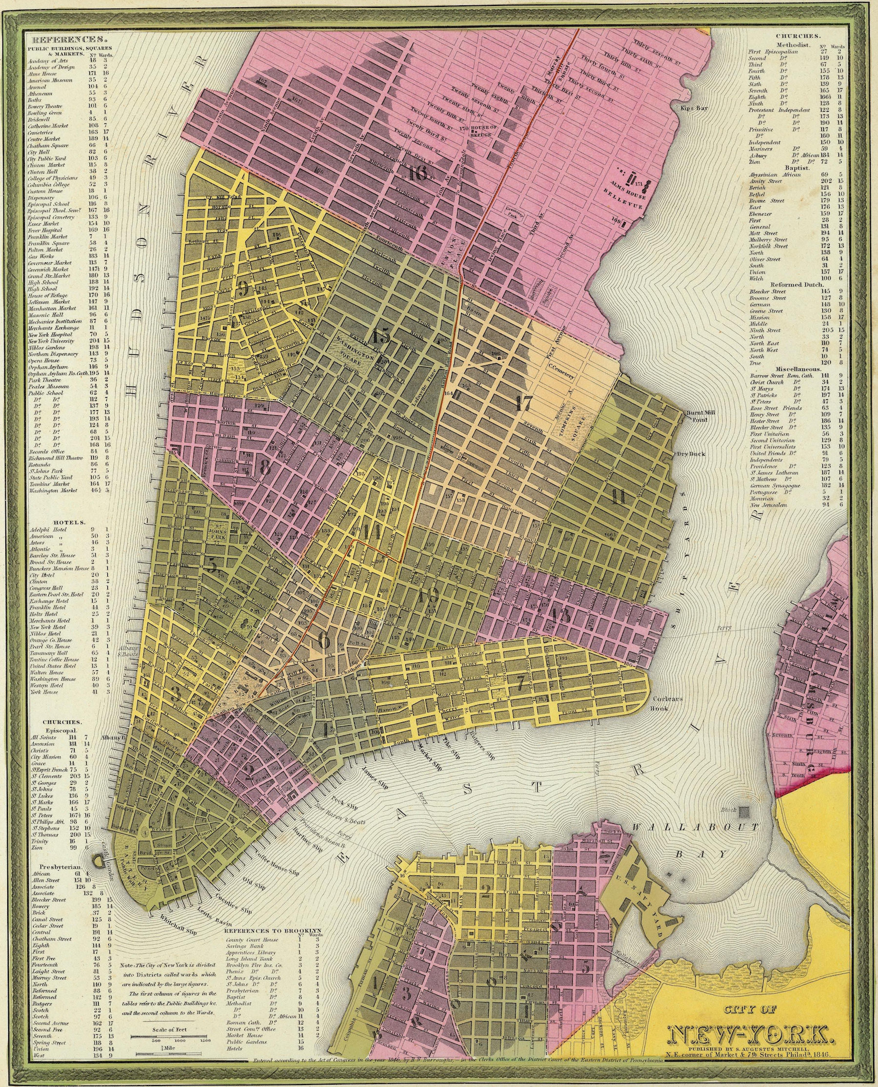
City Of New York. Samuel Augustus Mitchell, 1846, from 3: Residential
Source: David Rumsey Maps

Plate 32: Map bounded by Houston Street, Crosby Street, Prince Street, Marion Street, Spring Street, Laurens Street. Perris-Browne, 1853, from 3: Residential.
Source: Lionel Pincus and Princess Firyal Map Division, The New York Public Library Digital Collections.
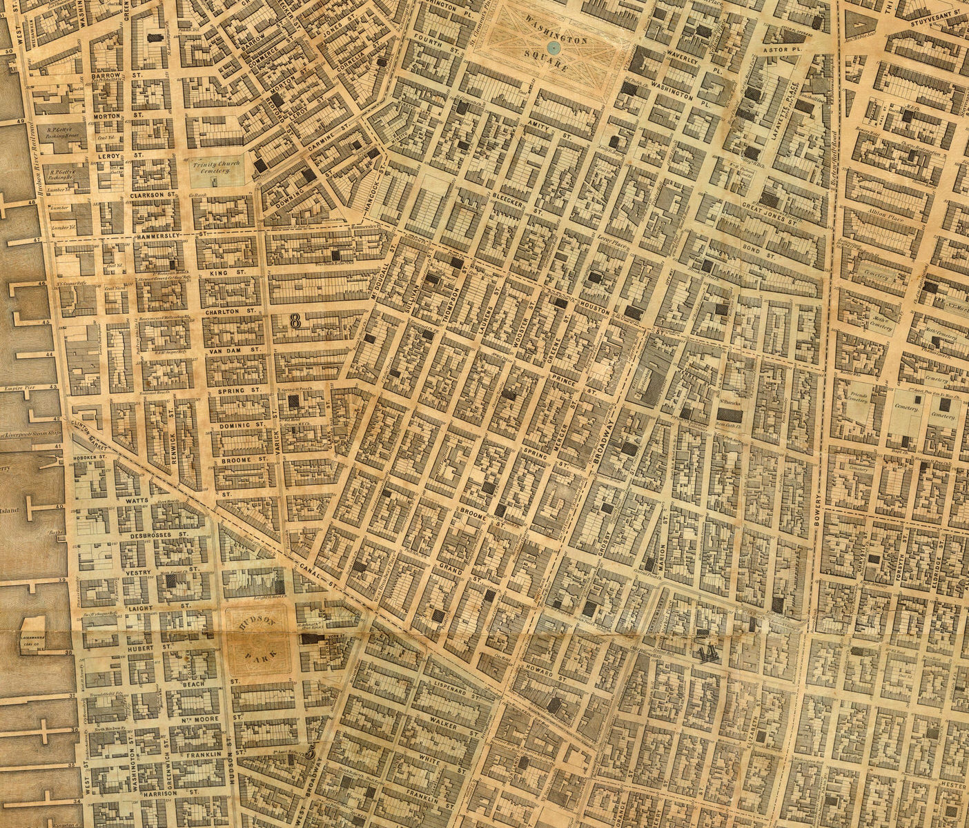
Map of the city of New York extending northward to Fiftieth Street, Matthew Dripps, 1852, from 3: Residential
Source: David Rumsey Map Collection
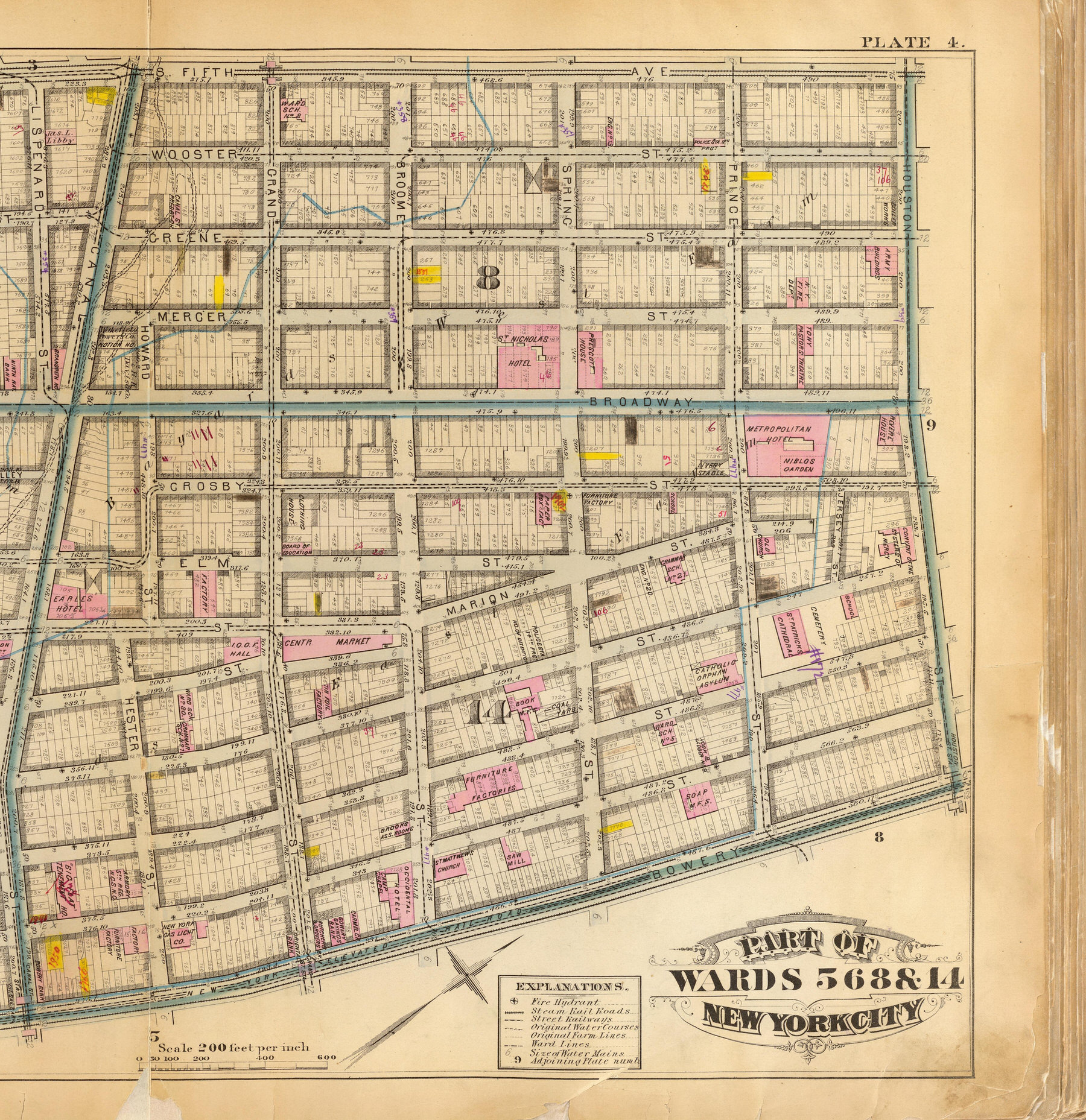
Part of wards 5, 6, 8 & 14, New York City, G.W. Bromley & Co.,1879, from 4: Brothels
Source: David Rumsey Map Collection
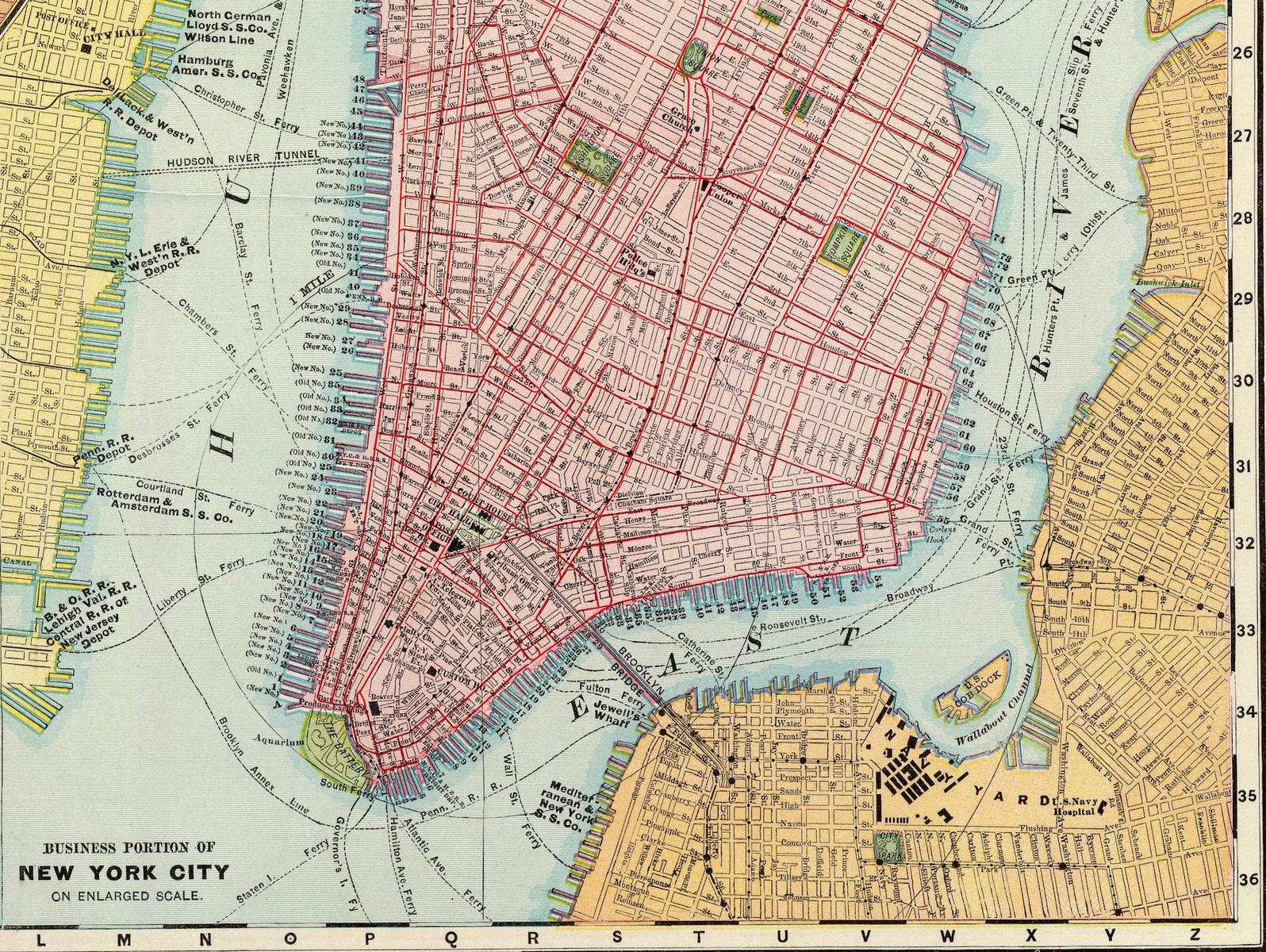
Map of New York City, by Rand McNally and Company, 1897, from 5: Garments and Infrastructure
Source: David Rumsey Map Collection

Map of the New York Central and Hudson River Railroad and its principle connections, Rand McNally, 1876, from 5: Garments and Infrastructure.
Source: Library of Congress

Ethnic Map, John B. Trevor for the Join Legislative Committee Investigating Seditious Activities, 1919, from 6: Labor
Source: New York State Archives, found at New York Times

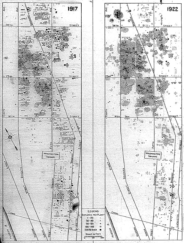
Clusters of Garment Factories, 1900-1922, from 6: Labor.
Source: From B.M. Selekman, Henriette R Walter, W.J. Couper. “The Clothing and Textile Industries.” In Regional Survey of New York and Its Environs, Volume IB: Food, Clothing and Textile Industries Wholesale Markets and Retail Shopping and Financial Districts, edited by R.M. Haig and R.C. McCrea. New York: Regional Plan of New York and Its Environs, 1928."

Holden-McLaughlin Plan, 1945, from 7: Urban Decay and Planning
Source: found in Schwartz, Joel. The New York Approach: Robert Moses, Urban Liberals, and Redevelopment of the Inner City. Ohio State University Press: 1993, 148.

Lower Manhattan Expressway, New York City. Map showing proposed development, Paul Rudolph, 1967, from 7: Urban Decay and Planning.
Source: Library of Congress

Soho Newsletter, 1971, from 8: Artists
Source: SoHo Artists Assocation Records, Archives of American Art.